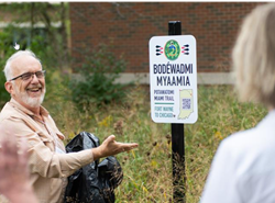
Bodéwadmi-Myaamia Trail
Potawatomi-Miami Trail
On September 29, 2023 the first markers of the Bodéwadmi-Myaamia Trail were installed on the campus of Anabaptist Mennonite Biblical Seminary. Eighth Street representatives serve on the Potawatomi-Miami Trail Marker Group. An Eighth Street Shalom Gift in 2022 supports the group’s efforts to mark the trail from Ft. Wayne to Lake Michigan and to expand the trail website. Maps of the townships of Elkhart County illustrate where the trail crossed the contemporary landscape.
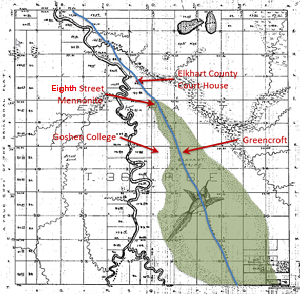
An 1830 surveyor’s map of Elkhart County outlines the Elkhart Prairie, highlighted on the map in green. The surveyor also located a trail (blue line) used by Native Americans for centuries, noting where it crossed the section lines that he was marking for the purpose of selling parcels of land to settlers.
Before the arrival of European settlers, Indigenous Peoples of numerous tribes used this trail to travel between what would later become Ft. Wayne and Indigenous settlements on the Saint Joseph River to the north. Just south of the river, a branch of the trail continued directly west to more settlements at the southern tip of Lake Michigan.
Both Myaamia (Miami) and Bodéwadmi (Potawatomi) lived in what is now northern Indiana. When European settlers arrived, the Myaamia were primarily in the southern areas and the Potawatomi were in the north.
Maps on the trail website reveal that Eighth Street Mennonite Church is located on what was the far northern tip of the prairie where it transitioned into oak savannah. The trail passed through what is now the church parking lot near Ninth Street. It continued northwest through what is now the Elkhart County Courthouse square in downtown Goshen.
To the south, the trail traversed today’s Greencroft Goshen campus, through the current site of Evergreen East (Central Manor). Goshen College is located between the Elkhart Prairie and the Elkhart River.